Bicycle routing (MTB)
Overview
Bicycle routing considers factors such as the availability of bike paths, trails, and roads that are safe and legal for bicyclists. OsmAnd always uses elevation data when calculating the estimated time of arrival (time to cover the distance) according to Naismith's rule. By default the fastest route is provided.
Bicycle routing can also be useful for mountain biking.
You can configure Bicycle routing in the Route parameters section of the Navigation settings.
Route Parameters - Bicycle
OsmAnd's bicycle routing features allows cyclists to input a start and end point, and then generate a route that takes into account their preferences and local geography.
- Android
- iOS
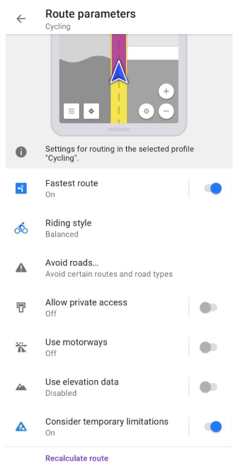
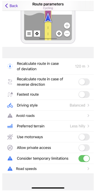
| Parameter | Description | Note |
|---|---|---|
| Fastest route | The routing mechanism will choose more direct and, accordingly, faster roads. | Despite the increase in the speed of movement, the distance traveled also increases at the same time. This leads to an increase in muscle effort. |
| Riding style (Android) Driving style (iOS) | You can choose your riding style for a better routing.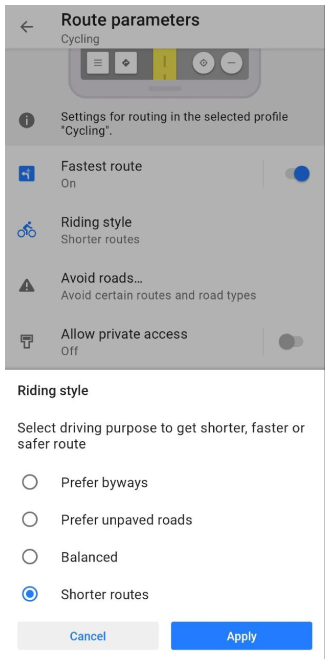 |
|
| Avoid roads… | Select roads you want to avoid during navigation.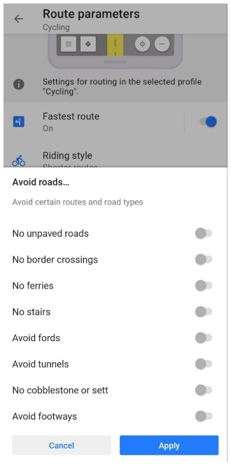 | You can either select a road on the map or choose road type(s) from the list:
|
| Allow private access | Private access restrictions will be ignored when route calculating. | Tag private is used in OSM to describe restrictions on the use of highways and other transportation routes, as well as buildings, entrances, amenities, and leisure entities. |
| Use elevation data (Android) Preferred terrain (iOS) | Elevation data will be used in route calculation: penalties for roads with another elevation profile will be set.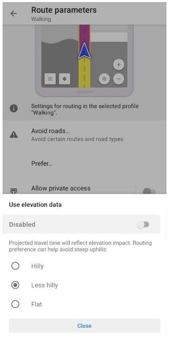 | This preference can help avoid steep hills or vice versa, prefer them. If you choose hilly route, preference will be given to hills and mountains. If flat - to flats, hills will be avoided. Less hilly preference is something in between these two options. Without elevation data the fastest route as on plain terrain will be calculated. |
MTB routing particularities
The MTB (mountain biking) routing mechanism is the same as bicycle routing. Note, that there are some penalties for using MTB routes, and therefore they are less likely to be offered for cycling to home or to work.
Other Routing Settings
-
The routing algorithm can also consider temporary limitations specified in OpenStreetMap. This can be done using Consider temporary limitations option. Note that in some cases, information from OSM can be outdated.
-
In the Recalculate route section of the Route parameters, you can enable and adjust route recalculation options.
-
In the Development section of the Route parameters, you can try new routing features that are currently in the testing phase. Note, that these settings are only available when the OsmAnd development plugin is enabled.
-
Road speeds setting in the iOS version of OsmAnd is located in Navigation settings → Route parameters (for Android, in Vehicle parameters → Default speed). This setting is used on unknown roads without speed limits. This is most often the case when navigating a track or online route. It must be set according to the parameters of your vehicle.
-
Vehicle parameters. Properly configuring the settings will help you avoid problems when creating a route. You can select the most appropriate route depending on the type of vehicle and road restrictions, as well as calculate the travel time.
Last updated: June 2024