Public Transport
Overview
Public transport is an additional layer that allows you to display transport routes and stops on the map, to check detailed information about them and to navigate.
Transport Stops (Layer)
Enable/Disable Public transport layer:
Android: Menu → Configure map → Transport → …
iOS: Menu → Configure map → Transport → …
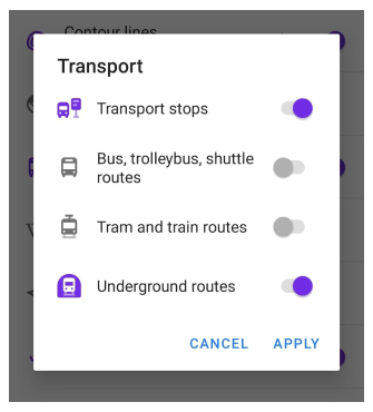
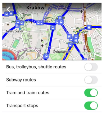
Choose between 1 or more transport categories for displaying:
- Transport stops
- Bus, trolleybus, shuttle routes
- Tram and train routes
- Subway routes
Read more about how transport is displayed on the map.
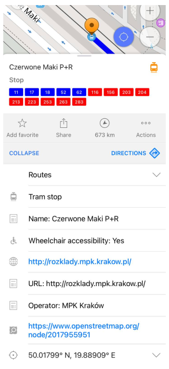
Transport Routes (Context Menu)
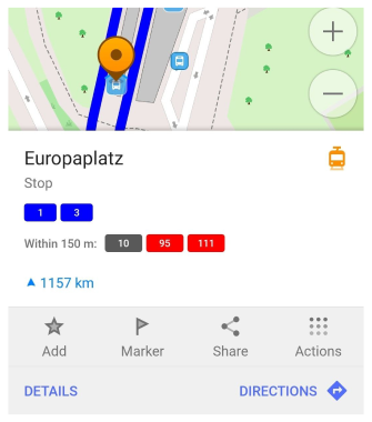
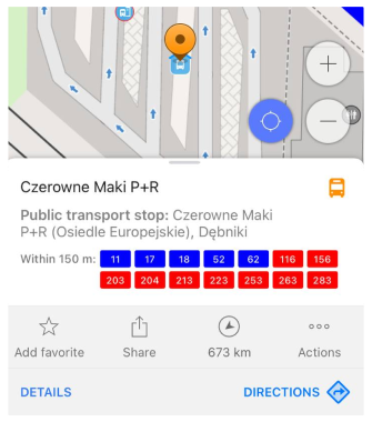
To open Transport menu, you can tap the the transport icon. It displays:
- Public transport coloured Shields (clickable)
- List of the routes stopping on that stop or nearby (within 150 m)
- Name of the stop and other details
Transport Stop Details
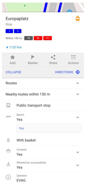
Public transport stop provides extra details comparing to standard OpenStreetMap object menu:
- Bench presence
- Cover presence
- Wheelchair accessibility
- Operator name
Note: you can filter stops by certain criteria. For example, expand & tap "Bench" / "Yes" and you can see the list of stops with benches. Also they could be shown on the map.
Routes
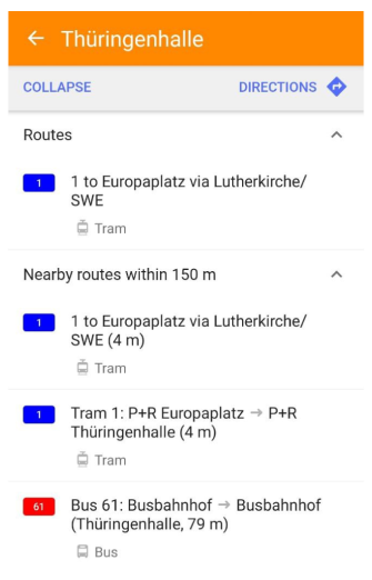
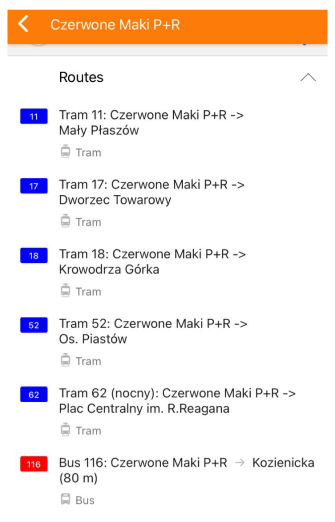
Transport Routes are all public transport routes that approach via selected stop and nearby routes (within 150m). Routes information is taken from OpenStreetMap data such as ref, name, colour and type.
Shield color:
- Subway - own color line
- Railway - brown
- Bus and other - red
- Tram - blue
- Trolleybus - purple
Browse Route
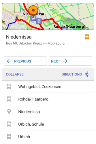
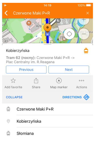
You can enter Browse Route menu by clicking on a shield or selecting a route from the routes list. After that you can browse between stops by clicking 'Previous' and 'Next'. Stop info will be updated in the menu and stop will be located on the map.
You can see the full list of stops by clicking Details. Currently selected stop is marked with 'location' icon on the Routes list.
NOTE: If you tap Directions button you will get a route from your current location to the selected Public Transport Station.