Points on the Map
Overview
The map can display points such as Favorites, Points of Interest, Markers, Wikipedia, Search results, Audio and Video notes, and OSM editing.
Favorites
- Android
- iOS
Go to: Menu → Configure map → Favorites
Go to: Menu → Configure map → Favorites
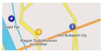
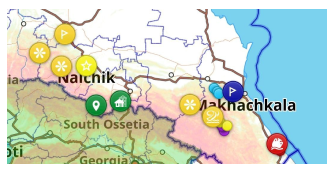
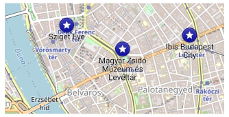
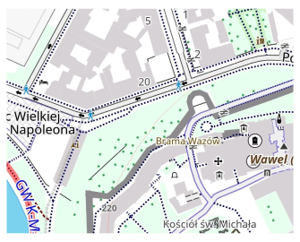
Favorites are special points marked by users. By default, they appear as yellow stars on the map, although they can be customized with any color, shape, and icon. They become visible on the map starting at zoom level 6.
In the Android version of OsmAnd, you can display only certain group favorites on the map and during the search. Go to Menu → My Places → Favorites, tap ⋮ and choose either Show it on the map or not.
Favorite and POI Names
- Android
- iOS
Go to: Menu → Configure map → Point Labels (POI, Favorites)
Go to: Menu → Configure map → Point Labels (POI, Favorites)
By default, Favorites and points of interest (POI) are displayed without names, so as not to clutter up the map with text. You can enable names in the Configure map menu.
Points of Interest (POIs)
- Android
- iOS
Go to: Menu → Configure map → POI overlay…
Go to: Menu → Configure map → POI Overlay
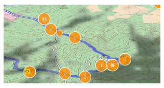
Points of interest (POIs) are specific locations marked with a symbol on the map. They indicate interesting or useful places and objects and are part of the Vector Maps.
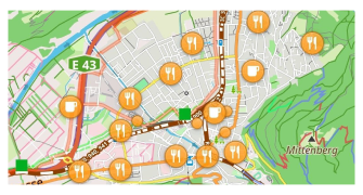
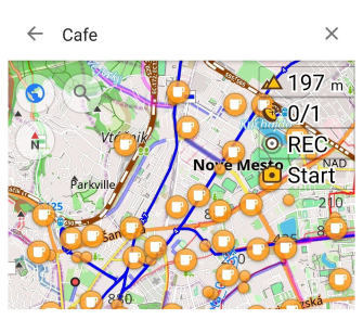
The most notable POIs are displayed on the map automatically. However, you can select a specific type of POIs (e.g. Restaurants) and all of them will be highlighted on the map with an orange circle (starting at zoom level 9).
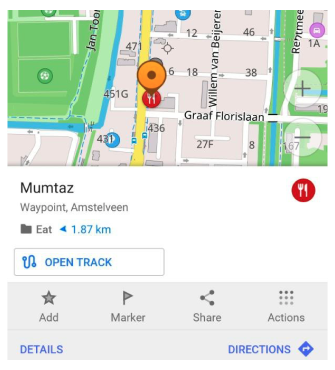
Detailed information about a point of interest can be found in the Context menu that appears when you tap on the point.
POI Types
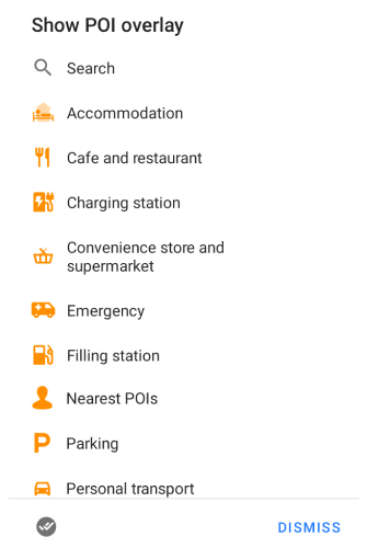
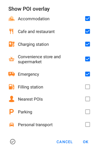
You can select one or many from standard OsmAnd POI types, or make your own POI filter and select it to display POI on the map.
Android. Tap the lower left button to switch between selecting one or more points of interest.
Map Style POI
- Android
- iOS
Go to: Menu → Configure map → Map rendering → Hide
Go to: Menu → Configure map → Configure map → Hide
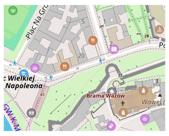
Each POI type in OsmAnd assigned a specific icon and color. POI's zoom level and design could be different in some map styles.
Markers
- Android
- iOS
Go to: Menu → Map markers
Go to: Menu → Map markers
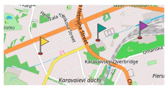
Map markers are temporary points marked on the map as flags. Their appearance can be customized using arrows (Arrows on the map) and distance indication (Direction lines).
You can read more about the markers appearance in this article.
Track Waypoints
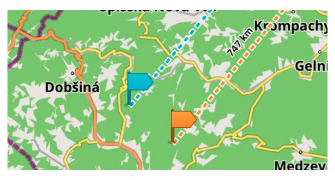
Track points (waypoints) are part of Track (GPX) files. These points are displayed automatically if the track is on the map. They look & could be configured similar to Favorites - icon, names, color, shape. How to create and add Waypoint, read in the article.
Read more about tracks on the map.
Search Results (POI)
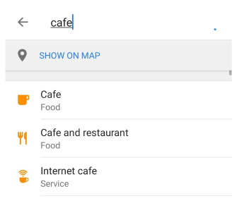
Search results could be displayed on the map as a special POIs layer. During the search, tap a special row (Show on map) to display POIs on the map.
To switch off POIs, hit X in the top right corner.
Read more about search.
* Street-Level Imagery
- Android
- iOS
Go to: Menu → Configure map → Street-level imagery
Go to: Menu → Configure map → Street-level imagery
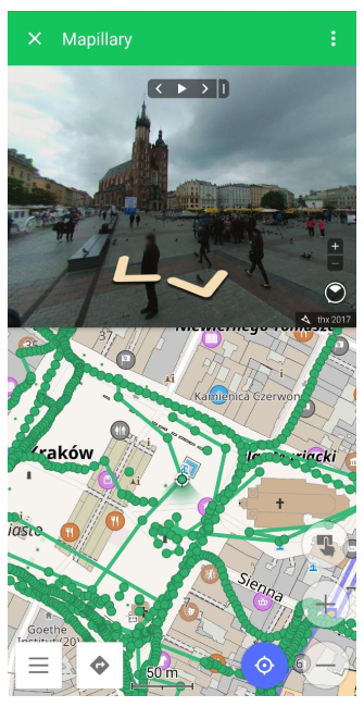
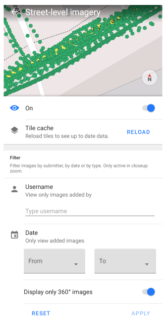
Street-level imagery (Mapillary) are displayed as green dots on the map. Photos of the street view are attached to these dots. You can create a filter and select the photos you want to display on the map. To open a street-view photo, tap the green dot.
Requires Mapillary plugin.
* Parking Point
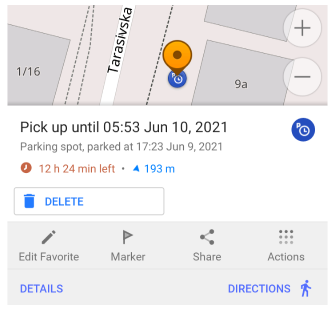
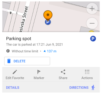
A Parking point is a point marked by users on the map to store information about the exact location of the vehicle. It can be divided into unrestricted and restricted parking zones.
Requires Parking position plugin.
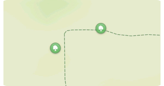
* Wikipedia
- Android
- iOS
Go to: Menu → Configure map → Popular places (Wikipedia)
Go to: Menu → Configure map → Wikipedia
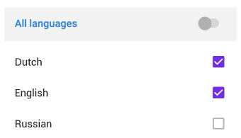
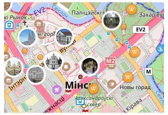
OsmAnd has special points of interest marked with a “W” logo and linked to Wikipedia articles. These points can be displayed just like any other POI type, via search or by going to Configure map → POI overlay…. However, there is a special way to filter Wikipedia articles by available languages.
Read more how to download and use the Wikipedia feature in OsmAnd.
* Audio / Video Points (Android)
- Android
Go to: Menu → Configure map → Recording layer
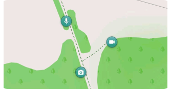
Audio / Video notes are points with audio, photo, and video data on the map created by users.
Requires Audio / Video note plugin.
* OSM Edit Points
- Android
- iOS
Go to: Menu → Configure map → OSM edits
Go to: Menu → Configure map → Configure map → OSM Edits
OSM edit points are POIs created by users to be added to the OpenStreetMap project.
Requires OSM Editing plugin.
* OSM Notes
- Android
- iOS
Go to: Menu → Configure map → OSM notes (online)
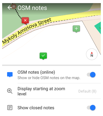
Go to: Menu → Configure map → Configure map → OSM Notes (online)
OSM notes are user-created POIs for reporting issues with map data in OpenStreetMap. New notes (not yet uploaded to OpenStreetMap) are marked in green with a +, closed notes are marked in green with a “V”, and open notes are marked in red. You can customize the zoom level for displaying notes and choose whether to show or hide closed notes.
Requires the OSM Editing plugin.
Points Along the Route
Waypoints, POIs, Favorite points, and Audio/video notes all refer to the concept of saving locations and routes in GPX (GPS Exchange Format). You can use the same tags to describe and edit them.
Waypoints are individual points on a map or route. They can be used to mark certain places that may be important for navigating or recording your travels. For example, you can create a waypoint on the map to indicate an important intersection or change of direction.
Points of interest(POIs) are places of special interest to users. These can be landmarks, restaurants, hotels, gas stations, and other places of interest that you may want to note or visit.
Favorite points are places users find particularly important or interesting and save to their list of favorite places. Places can include any location you may want to find and return to later.
Audio/video notes. In GPX format, you can save audio and video recordings as waypoints. This allows you to associate media files to specific locations on the map or route.
All of these point types can be saved in GPX format to provide you with location information and help with navigation and route planning. They serve different purposes, but the general idea is to store and transmit geographic information so you can use it in their navigation tasks.