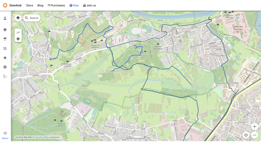
Web Route Planner
Overview
The osmand.net/map site is currently being developed and tested.
Therefore, the layout and operation of some functions on the site may be different from those described in this article.
We created the Discussion theme on our GitHub so you can leave feedback there.
The following features are available for users of the Free version of OsmAnd and for users with the Pro version  :
:
| Features | Versions |
|---|---|
| OsmAnd Pro sync | |
| Weather | Free |
| Tracks | |
| Favorites | Osmand Start or |
| Navigation Route | Free |
| Create track | Free |
OsmAnd Pro and OsmAnd Start sync
- OsmAnd Pro is a cross-platform paid subscription.
- OsmAnd Start is a free OsmAnd Cloud registration.
The cross-platform capability allows you to use OsmAnd Pro on all platforms (Android ← → iOS → Web). To do this you need to:
- Subscribe to OsmAnd Pro. Read more about how to do this for Android here, and for iOS here.
- How to create OsmAnd Start account read more here.
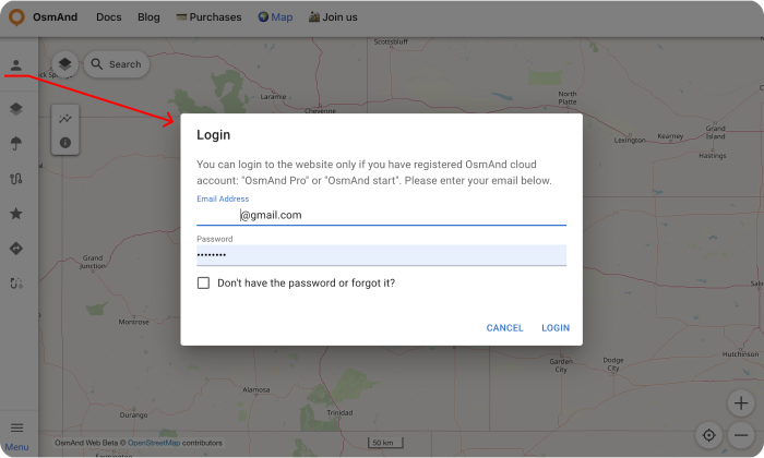
- Register your Pro or Start account on the OsmAnd server inside OsmAnd app.
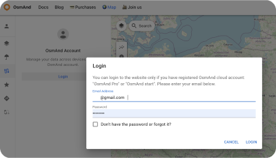
- The registered email will be your login to activate OsmAnd Pro on the web platform. At first, time needed to choose a password for future entering the web portal (please, use the instruction on the web portal).
- Enter your email and password for osmand.net/map.
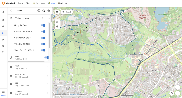
- Your data, such as tracks (OsmAnd Pro) and favorites(OsmAnd Pro and OsmAnd Start), will appear in the menu after you log in. They are available for display on the map. But you need to sync this data from your devices.
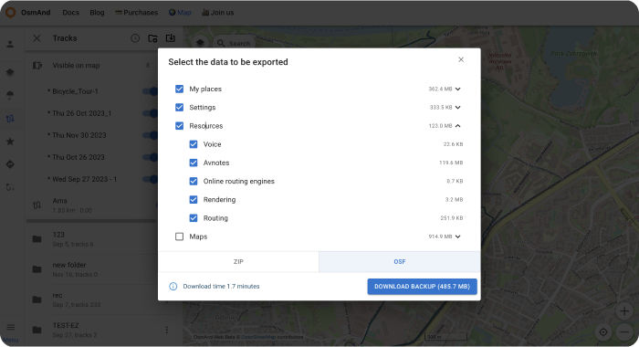
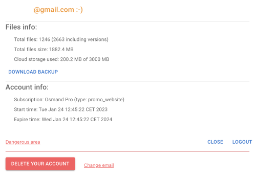
- To DOWNLOAD BACKUP from OsmAnd Cloud, click the login field. On the login field you can see files info (total files number, total files size, cloud storage used) and account info (subscription type, start time and expire time of your subscription).
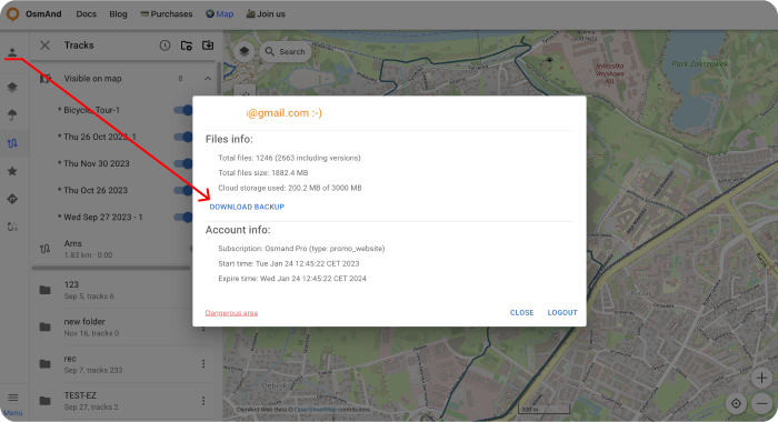
Choose needed files for downloading, .zip or .osf format of downloaded files and click DOWNLOAD BACKUP button:
There is also a button to logout of the account.
- LOGOUT, DELETE YOUR ACCOUNT or Change email you find on the login field too. For opening DELETE YOUR ACCOUNT or Change email you need to click Dangerous area.
Weather
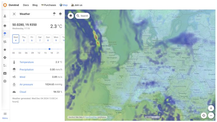
The Weather plugin is a paid feature of the OsmAnd app. For the web version, Weather is a free feature with such capabilities as:
- Enable weather layers on the map: Temperature, Pressure, Wind, Cloud cover and Precipitation using the menu on the left or right.
- Enable the display of the weather forecast for the day or week (the forecast step is 3 hours).
Tracks
It's a paid feature . At first you need to loggin your OsmAnd Pro:
For Track section:
- Show tracks from OsmAnd Cloud.
- Adding tracks on the map (Visible on map folder).
- Looking all tracks info and graph
- Modify tracks and add it to Cloud.
- Download and delete tracks.
- Create new folders or delete it.
- Download folders as
.osfor.obfcollection.
Visible on the map
Here there is a list of visible tracks on the map.
Switch on / off tracks for showing or not its on the map.
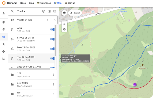
Track folder menu
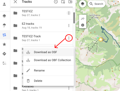
Click to the Tree points ⋮ button for open Track Folder menu. Here you can Download all tracks from chosen folder as:
Download as OSF
Download as OBF Collection: You can get OBF map from this data: OBF file or Travel OBF.
You can download offline map OBF (OsmAnd Binary Format) and open it with OsmAnd on device, it's suitable to display large quantity of tracks will be visible on the map.
Also You can import map of tracks as Travel book which will allow you also to select a specific track on the map and use it as normal GPX. Travel book also supports features such as displaying tracks as points, filtering tracks by activity type and filtering waypoints.
- Rename chosen folder.
- Delete chosen folder.
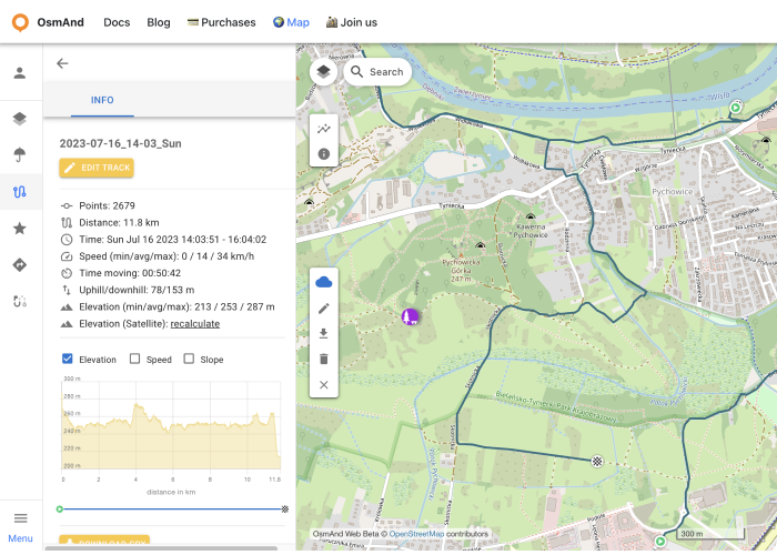
Cloud tracks
GPX tracks that you have in OsmAnd Cloud will be available for display and editing after login. Only for Pro users .
The following features are available after choosin cloud track:
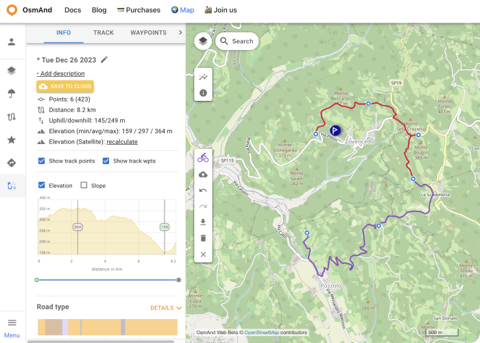
Information screens:
- Information - displaying track data.
- Elevation - graph of elevation.
- Speed - speed graph.
- Slope - slope graph.
- Settings - list of navigation profiles for the Create route tool.
Action buttons:
- Edit track - adding cloud track to local for editing (Edit locality button on the panel).
- Download GPX - downloads the track to the PC.
- Recalculate Elevation (Satellite) - displays the elevation graph of the selected track.
- Delete Track - deletes the track.
- Close track - close the track.
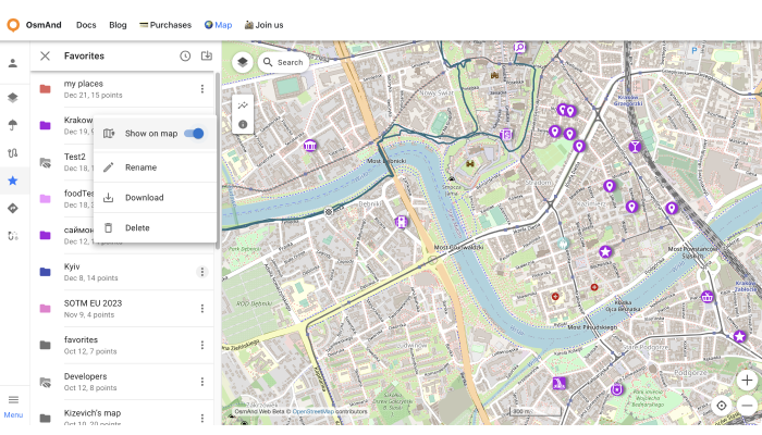
Favorites
After registering an OsmAnd Pro or OsmAnd Start, your Favorites are displayed in the Favorites menu.
The following actions are available:
- Show on map - show favorites points from the chosen folder on the map.
- Rename - name and description of favorite folder.
- Download - download the chosen favorite folder.
- Delete - delete the chosen favorite folder.
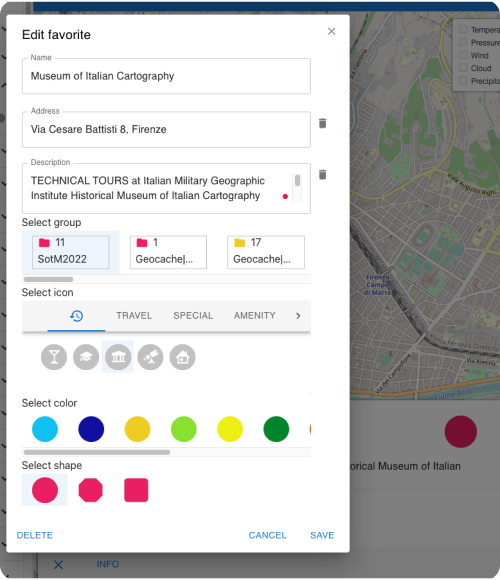
Add / Edit Favorite
To add a new favorite point, right-click on the screen. To start editing, click on the favorite point, the edit menu screen looks the same as the menu in OsmAnd app.
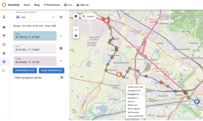
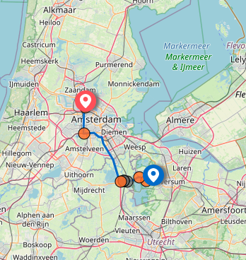
Navigation route
To start building a navigation route, right-click to add the Navigate from, Navigate to and Navigate via points.
After adding the start and end points, we get the route.
In the Route block you can move the start and end points, edit them and change the type of route.
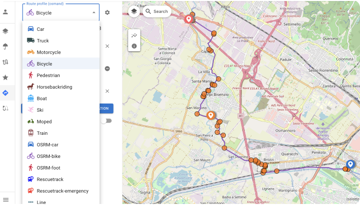
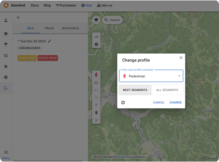
- choose Route profile for changing navigation routing type:
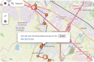
- click to Orange circles on Navigation route for look at instructions:
- copy URL for sending the navigation route. Example: https://test.osmand.net/map/?start=43.792163,11.215324&finish=43.852850,11.121941&via=43.812605,11.134644&type=osmand&profile=bicycle#13/43.8200/11.1352
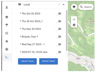
Create track and Local
A web version of the "Plan route" tool, similar to the OsmAnd app, is currently being developed. To go to create a route, Right-click → Create new Route. Or you can use the Create track button on the Local menu(right side: Pencil and Upload buttons).
Here you can select a navigation profile to build a section of the route (New segments) or for all route (All segments), add waypoints, save the route and view information about it.
You can view any actions and display track information in the Track section of this article.
Actions for Local:
- Import Track - any user can download any GPX file at osmand.net/map to Local section.
- Create track.
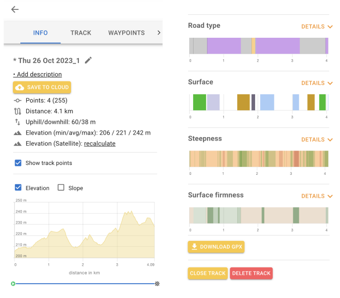
Local track menu and Edit has 3 panels: Info, Track, Waypoints, Turns.
Info actions and data:
- Save to Cloud.
- Add description.
- Rename a track.
- recalculate - Add elevation data for the selected track.
- Elevation: elevation graph.
- Speed: speed graph.
- Slope: slope graph.
- Road details - Road type, Surface, Steepness, Surface firmness, Piste.
- Download GPX button (Pro feature).
- Close Track the track.
- Delete Track - Delete the track.
Track section contains track points. Here you can delete it or change order. Waypoints menu contains track waypoints. Here you can show or not it on the map, and delete waypoints.
Turns menu contains info about segments turns.
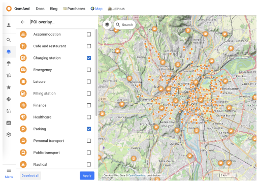
POIs on the map
Click to POI button on the side panel. Show POI menu: here you can choose POIs or search POI category for showing its on the map
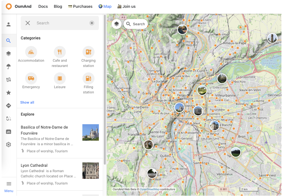
Search function
Write your request for searching and showing on the map. Click to circle for open POI's name.
URL scheme
For easy use of the OsmAnd application you can take advantage of direct links. These are special URLs that allow you to transfer location and contain detailed data about pins and tracks.
These address strings can be copied and transferred using any data transfer medium supported by your device and used in the Android or iOS versions of OsmAnd.
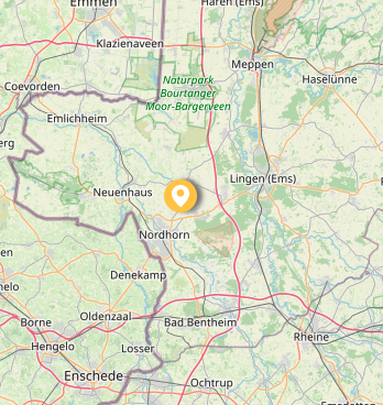
URL with a pin on the map:
https://osmand.net/map/?pin=52.491143,7.116394#9/52.3924/6.3116
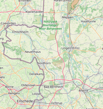
URL without a pin on the map:
https://osmand.net/map/#9/52.3924/6.3116
URL with navigation:
Depending on the specified parameters, URL strings may contain:
- latitude: latitude value as a number.
- longitude: longitude value as a number.
- start-finish: for navigation.
- profile: for navigation.
- zoom: zoom level.
Related Articles
This article was last updated in January 2025