Public Transport routing
Overview
Public transport navigation in the OsmAnd app allows you to work out the routes using public transport, which will certainly help you get around the "concrete jungle" faster.
Data on public transport routes is taken from the OpenStreetMap project. OsmAnd uses the PTv2 scheme for navigation. OsmAnd supports following OpenStreetMap routes for navigation bus, trolleybus, share_taxi, funicular, subway, light_rail, monorail, train, tram, ferry. Default speed for each type of vehicle is configured in Routing xml and it used to find the fastest routes.
Public transport routing is in the testing phase. For now, you can build and view your route without the full navigation function.
- Android
- iOS
How to Use
To start navigating around the city by public transport, use the navigation button on the map screen or select the navigation option in the Main Menu.
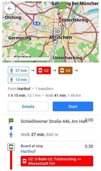
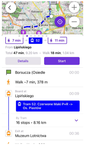
1. You need to choose Public transport navigation profile, start and destination points.
- Android
- iOS
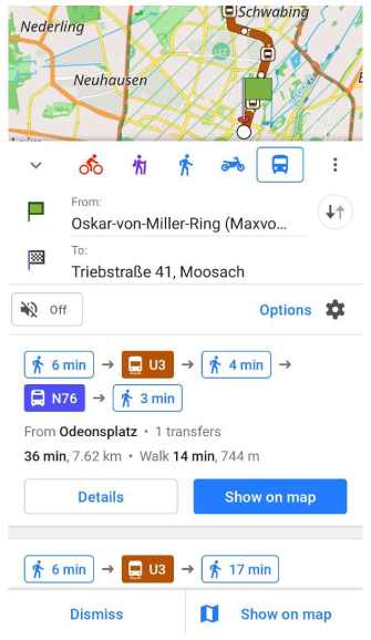
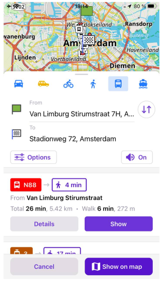
2. OsmAnd offers route options with walking times and public transport routes with route information: time, distance, transfer, and public routes. You need to scroll through the navigation screen to select the required option.
- Android
- iOS
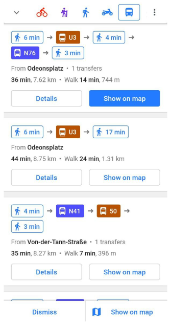
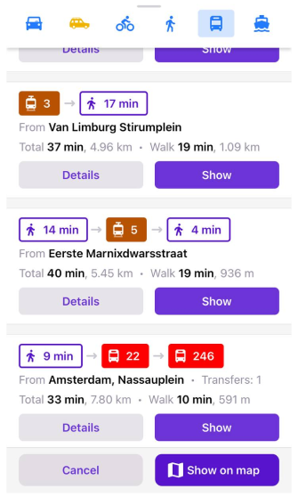
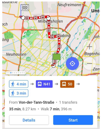
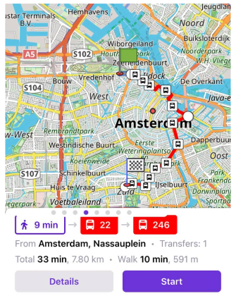
3. You can view all possible route suggestions on the map using the Show on map button. Swipe through the screens to view the next route option.
- Android
- iOS
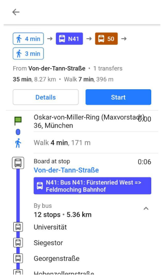
4. Tap the "Details" button to open a description of the selected route with all stops and transfers.
- Android
- iOS

Data and Guideline
OsmAnd uses a new public transport scheme, also called Public Transport Version 2 (PTv2) for the OsmAnd Public Transport navigation algorithm.
- You can check your public transportation here.
- A guide to building or adjusting public transport routes is available on our blog.
- The presentation 2019: Public Transport Navigation using OpenStreetMap by OsmAnd.
Last updated: June 2024.