OsmAnd 5.2 (iOS)

OsmAnd 5.2 for iOS — Now Available!
We're excited to announce the release of OsmAnd 5.2 for iOS! This update delivers powerful customization and clarity improvements. Key features include the new Marine Map Style for nautical navigation, Custom Button Binding for external controllers to map any Quick Action, and enhanced map display with text outlines for all widgets and a precision grid for aligning map buttons. Download now for a smoother, more personalized experience!
What's new
- Added custom button binding for external controllers, with the ability to assign any Quick Action to a keyboard button;
- Added text outlines to all widgets for better visibility;
- Added the ability to resize text in the Distance by tap tool;
- Added a precision grid for aligning your map buttons;
- Moved the temperature units selection to General Settings;
- Added altitude units setting;
- New Marine map style;
- Improved UI for adding truck metrics in Truck profile settings;
- Other improvements;
- Bug fixes;
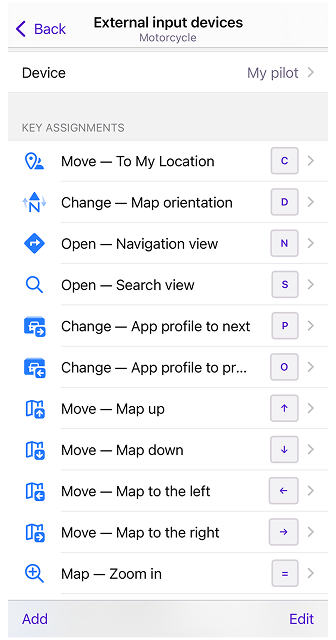
Custom button binding for External Controllers
OsmAnd now supports customizable buttons for external controllers. You can assign any Quick Action to a keyboard button, allowing for a more personalized navigation experience:
Menu → Settings → Choose Profile → General settings → External input devices → Device → Add
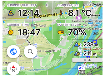
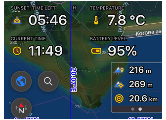
Text Outlines for Widgets
All widgets now feature text outlines, enhancing visibility against various map backgrounds.
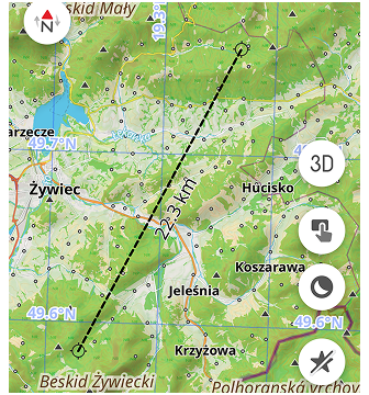
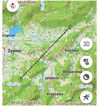
Resizable Text in Distance Measurement Tool
You can now resize the text in the Distance by tap tool. Two variants are available: Normal and Large, making it easier to read distances on the map.
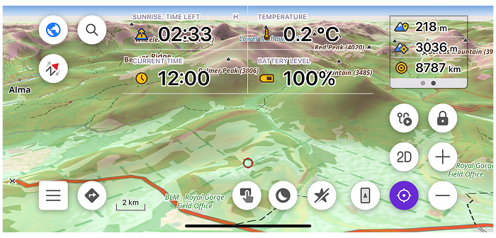
Precision Grid for Aligning Map Buttons
A new precision grid has been added to help you align your map buttons more accurately.
Temperature Units in General Settings
The temperature units selection has been moved to General Settings for easier access:
Menu → Settings (Select Profile) → General Settings → Units & formats → Temperature (Device settings, Celsius or Fahrenheit)
Altitude Units Setting
Users can now set altitude units (meters or feet) separately from distance units in the settings:
Menu → Settings (Select Profile) → General Settings → Units & formats → Altitude (Meters or Feet)
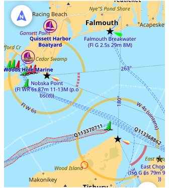
New Marine Map Style
"Marine" is a new nautical map style designed for maritime navigation. This style displays light characteristics, sectorial lights, and other maritime features. The Map Configure menu after enabling "Marine" style has additional options for customization in the "Other map attributes" section.
Improved UI for Truck Metrics
Now, you can add special truck metrics for Truck profile directly from the profile settings:
Menu → Settings (Track profile)→ Navigation Settings → Vehicle parameters: Max axle load, Max weight at full load
Other Improvements
- General stability and performance improvements on CarPlay;
- Improved place of Location icon on CarPlay;
- Added Auto zoom for 3D angle;
- Showed grouped regions for USA, Australia, UK downloads;
- Improved selection of type colorisation for tracks;
- Added setting of enabling Next turn information for Street name widget;
- Added ability to reconnect to sensor by tapping on the widget;
- Added the Radius Ruler widget to Top and Bottom panels;
- Showed distance on graph slider in the Track Context menu;
Bug fixes
- Fixed an issue that prevented some widgets from being move;
- Fixed incorrect distance display in 'Next Turn' widget;
- Fixed bug with map updates appearing in iCloud Backup;
- Fixed bug with Update All button;
- Fixed bug with not exporting of tracks appearing to info files in OsmAnd Cloud;
- Fixed CarPlay switching to the first Driving profile when switching to the Dashboard and back;
If you have suggestions for improving the iOS version of the app, please get in touch with us. We appreciate and welcome your contribution to the further development of OsmAnd.
-
Follow:
Follow OsmAnd on Facebook, TikTok, X (Twitter), Reddit, and Instagram!
-
Join:
Join us at our groups of Telegram (OsmAnd News channel), (EN), (IT), (FR), (DE), (UA), (ES), (BR-PT), (PL), (AR), (TR).
-
Get:
