Android 4.9 (beta)
Android 4.8 is the latest release that introduces many new features and improvements to the OsmAnd app. This article describes all the key updates that represent meaningful changes for our users.
Join Beta
OsmAnd releases several Ready-To-Use builds daily, allowing you to track new features and participate in the OsmAnd translation process. You can take part in testing the beta version of OsmAnd using Google Play.
What's new
- Introduced Main Navigation widget,
- Added a full-screen gallery viewer for Wikimedia images,
- Introduced a new plugin "Vehicle Metrics" to monitor vehicle performance using the OBD-II protocol,
- Added the ability to assign activities to tracks and filter them accordingly,
- Introduced customizable map button appearance and a precise grid,
- Added a Widget Context menu and a "Reset average speed" action to widgets,
- Added new actions for Quick Action:
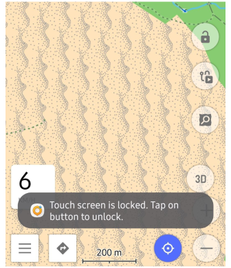
- Action for touchscreen lock,
- Implemented new quick actions for trip recording,
- Quick action to control visibility of OSM Edits.
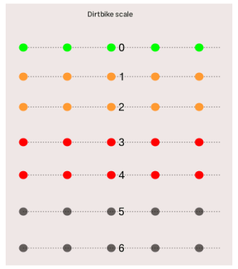
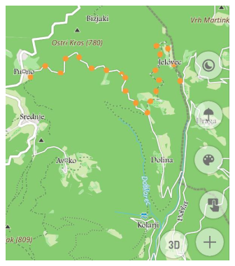
- Added new route layer "Dirt Bike trails",
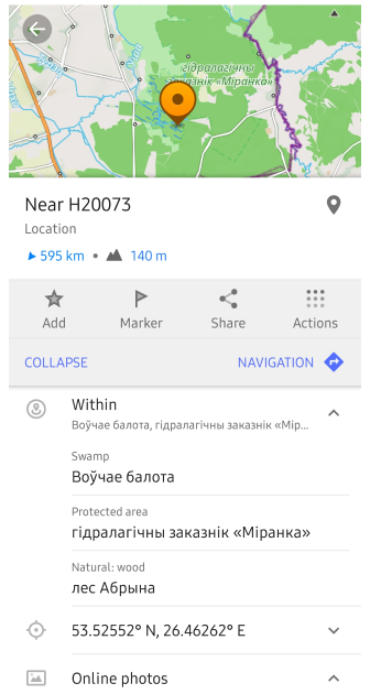
- Added information about surrounding areas for the selected point,
- System font everywhere,
- Separated visibility parameters for Terrain colorization options,
- Tappable icon to display access or other road or path attributes,
- Renamed "Difficulty classification" to "Hiking trails difficulty grade",
- Fixed issues
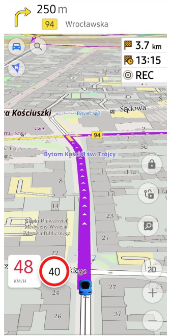
Main Navigation widget
Added the Main navigation widget for Top panel: Configure screen → Top panel → Route guidance: Next turn, Second next turn, Lanes
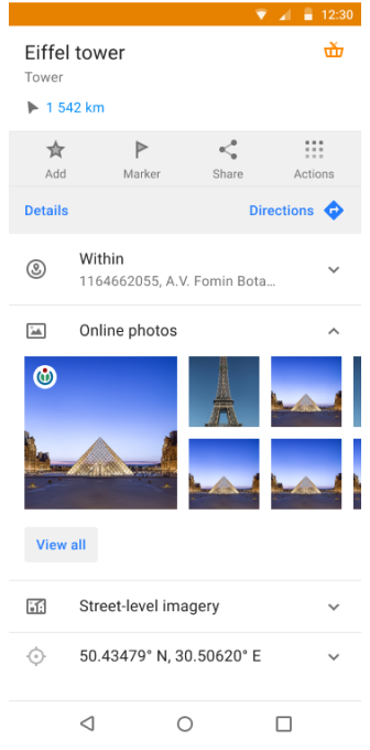
Images Gallery
Added on Map Context menu full-screen gallery viewer for Wikimedia images.
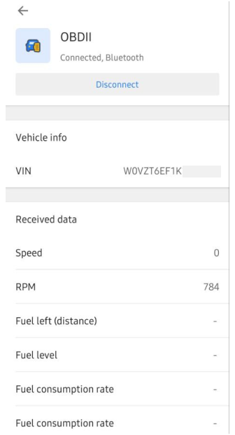
Vehicle Metrics
The new Plugin - Vehicle Metrics was added to the Plugins menu. It monitors key vehicle metrics using the OBD-II protocol. New widgets for this data were added too.
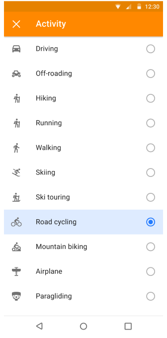
GPX Track activities
The new feature of adding Activity to a recorded GPX track improves navigation and track management (filter). This increases the convenience of working with track recordings.
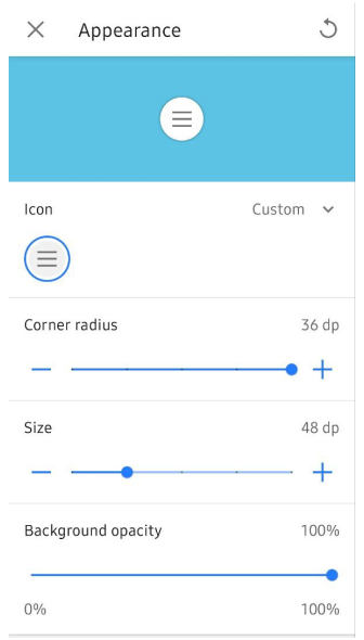
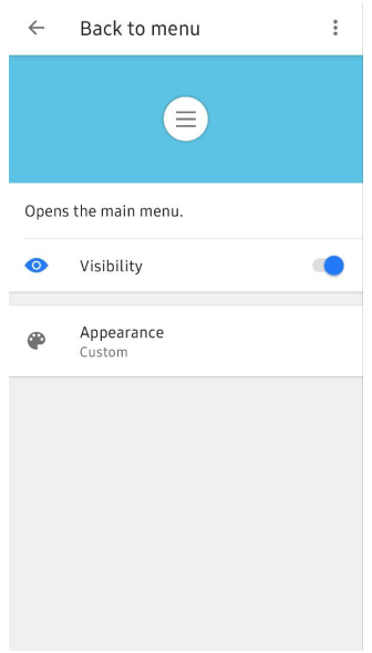
Customizable Map buttons
No you can modify the appearance of Quick Action buttons and Default buttons through the three-dot menu: Menu → Configure screen → Custom buttons or Default buttons → choose needed buttons → three-dot menu → Appearance (chagne icon, corner radius, size, background opacity).
Added grid for buttons.
Added Custom buttons to export/import settings.
Widget Context Menu
The Widget Context menu allows you to manage and configure widgets directly from the map screen, providing a quick way to organize panels. You can access this menu by long tapping on any widget to customize the layout of widgets without leaving the map.
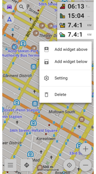
Reset average speed
Added the "Reset average speed" action of the current value in Widget Context menu.
New actions for QA
Added new actions:
- Action for Lock/Unlock screen: Menu → Configure screen → Custom buttons → + → Add acton → Inteface → Lock screen
- Actions for Trip recording: Menu → Configure screen → Custom buttons → + → Add action → My Places → Start/Pause - Trip recording, Start new trip segment, Finish Trip recording, Save Recorded Trip & Continue
- Action for Show/Hide OSM edits: Menu → Configure screen → Custom buttons → + → Add action → My Places → Show/Hide OSM edits
Dirt Bike Trails
Added new Route options - Dirt bike trails: Menu → Configure map → Routes → Dirt bike routes . Read more about dirtbike tag.
Upon activation, display a colored route overlay for all paths marked with the dirtbike:scale tag, similar to the approach used for mtb:scale (Mountain bike).
Surrounding areas
Show data information to Map Context menu about surrounding areas (polygons) after long tap on the map:
Long tap on the map → Map Context menu → Details → Within
Sort by polygon size: from small to big. Show polygon type and name.
System font
Use system font as font for OsmAnd menu:
Device settings → Display → Font size an style
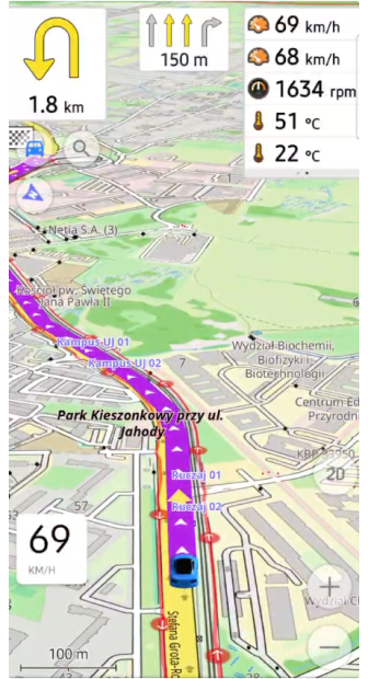
Visibility parameters for Terrain
Slope / Hillshade / Altitude have their own independant Visibility setting.
Tappable access actions
By tapping on Barrier, Steps, Gate icons in the Map Сontext menu now displays the name (POI type) and address:
![]()
Hiking trails
"Difficulty classification" was renamed to "Hiking trails difficulty grade":
Configure map → Routes → Hiking trails difficulty grade: SAC or CAI
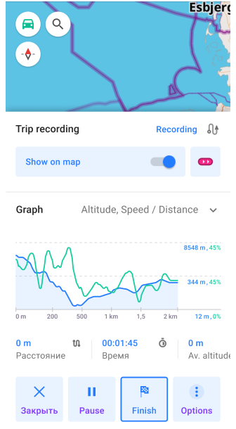
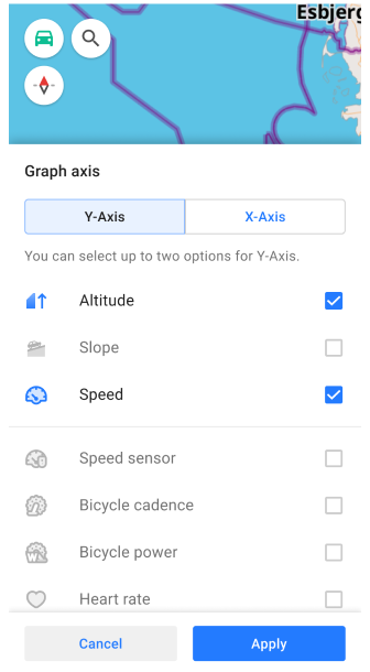
Change of graph toggle
Changed graph toggle (Recording track) to give the ability to select any available options for displaying on the graph.
Fixed issues
- "Auto-record track during navigation",
- Favorite search,
- Not visible Y-axis on graph,
- Showing Wikipedia overlay,
- Samsung DeX sizes,
- Water transport routes are not displayed when selecting a stop,
- GPX track's name after saving,
- Crash when deleting track from Smart folder, applying a filter.
- Active Navigation mode(added "Continue navigation" action to the main menu) for Android Auto,
- Remembering 2D/3D setting for Android Auto,
- Treshold for free rotation mode,
- No effect of keys “D”, “N”, “S” of external Keyboards,
- Sun position widget: not show sunrise tomorrow,
- Slows down when turning on the track and coloring by speed and height,
- "None" doesn't work for "Analyze by intervals",
- Freezes in export list,
- 3D track incorrectly work,
- issue with fliped coordinates in RTL,
- Missed sensor data for currently recording track,
- Missed temperature for graph of "Analyze on map",
- Zoom for Points in Plan Route,