Перейти до основного вмісту

Checking the Distance. Working with Measuring Tools

· 8 хв. читання
Tina
Technical writer
Eugene
Marketing lead

Running every morning is just what you do. No discussion — just the street and whatever distance feels right that day. Your running partner lives on Yonge Street. So do you. Same street, different ends — and when he suggested a 7 AM run "somewhere in the middle", it sounded simple enough.

Yonge Street is 56 kilometres long. The longest street in the world, according to Guinness. It starts at Lake Ontario and runs straight north through Toronto until it quietly disappears near Holland Landing. "Somewhere in the middle" turned out to be a question neither of you had actually answered. You were both on Yonge Street — technically neighbours — and had absolutely no idea how far apart you were standing.

A few taps in OsmAnd, and the guessing stopped. Distance by tap, radius circles, a straight line to your meeting point — tools that turn a vague sense of scale into something exact.

Yonge Street

Planning a Day on the Water with Nautical Maps

· 8 хв. читання
Tina
Technical writer
Eugene
Marketing lead

Some trips exist first as an idea. You open a map, find a coastline, and start building something in your head — a route, a few stops, maybe a harbor where you'd want to spend the evening. A principality of your own, even if just for a week. Principality of Monaco takes that idea literally. In summer the water gets crowded quickly — and what looks like open space from the shore has its own logic underneath. Shallow patches, restricted zones, boats coming and going from every direction. You don't notice any of it until you're already in the middle of it.

A regular map won't tell you any of that. Roads, buildings, points of interest — useful on land, but the moment you're moving on water, the map needs to change completely.

This is what OsmAnd's Nautical Map View is for. Depth data, seabed information, navigation lights, buoys, fairways — the kind of detail that turns a general-purpose app into something you can actually use on the water. Whether you're planning a route along the Côte d'Azur or just trying to find a safe place to anchor for the night, it starts with a different kind of map.

Monaco harbor

From Map Data to 3D Buildings in OsmAnd

· 7 хв. читання
Tina
Technical writer
Eugene
Marketing lead

In films like Angels & Demons, Rome never feels flat. The city unfolds through narrow streets, archways, inner courtyards, and massive stone buildings rising above the crowd. You remember not only where the characters go, but the space around them — the height of the facades, the passages through buildings, the way entire streets disappear beneath arches before opening into another square.

But on most digital maps, cities lose that depth. Buildings become flat shapes, reduced to outlines that show where something exists, but not how the city actually feels. For mappers, this is where building data starts to matter.

In OpenStreetMap, buildings can contain far more than a simple outline. Mappers can describe a building's height, the number of floors, where different sections begin, and even passages running through the structure. OsmAnd uses this data to transform flat map geometry into detailed 3D cityscapes. Buildings gain height, complex structures become distinguishable, and streets start to feel closer to the real places they represent.

Castel Sant Angelo

Explore the Night Sky with OsmAnd Astronomy

· 7 хв. читання
Tina
Technical writer
Eugene
Marketing lead

Far from city lights, the sky looks different. In the Namib Desert, darkness comes quickly and the stars appear all at once, filling the entire horizon. At first, it feels simple. A guide points to a few constellations, maybe a bright planet. You follow along, recognising some shapes. But after a moment, you lose track. There are more stars than you expected, and it is hard to tell them apart.

This is where OsmAnd Astronomy changes the experience. Instead of guessing, you can explore the sky the same way you explore a map — step by step, with clear orientation, useful context, and the ability to plan what to look for next.

Namib Desert

OsmAnd Web 1.03

· 7 хв. читання
Tina
Technical writer
Eugene
Marketing lead

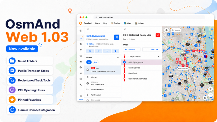
OsmAnd Web 1.03 — Now Available!

We're excited to announce the release of OsmAnd Web 1.03. This update introduces Garmin Connect integration for automatic activity sync, a redesigned navigation interface, improved management of personal data with Smart Folders and pinned Favorites, and enhanced track customization with adjustable color and width. It also improves POI information with opening hours displayed directly in the context menu, along with multiple usability improvements and bug fixes across the web map.

Enjoy a smoother and more intuitive OsmAnd Web experience.

Overview

Sync with Garmin Connect

· 5 хв. читання
Eugene
Marketing lead

Hello friends!
We are excited to announce a new feature that allows you to sync your activities from Garmin Connect™ with OsmAnd. This integration, now available for OsmAnd Pro users, enables you to automatically import your Garmin activities and view them in the Tracks section under a new folder called "Garmin Connect."

You can now easily access your Garmin activities within OsmAnd to use them for navigation, analysis, or sharing. This update makes it simpler to keep all your outdoor adventures in one place and seamlessy integrate your Garmin data with OsmAnd’s mapping tools.

Garmin Connect Sync

OsmAnd 5.3 (iOS)

· 12 хв. читання
Eugene
Marketing lead

OsmAnd 5.3 for iOS — Now Available!

Get ready to explore a new dimension. This update brings the highly anticipated 3D Buildings and Globe View to your iPhone, alongside a massive overhaul of the Trip Recording widgets. Whether you're navigating city skyscrapers or planning a transcontinental journey, version 5.3 offers more perspective and precision than ever before.

🔄 Update Now

OsmAnd 5.3

OsmAnd 5.3 (Android)

· 13 хв. читання
Eugene
Marketing lead

OsmAnd 5.3 for Android drops: Stars align, Earth curves!

Discover the cosmos with the Astronomy plugin's interactive star overlays, rearrange widgets effortlessly with flexible map layouts, marvel at beta 3D buildings and Globe View's spherical Earth, plus smarter track folders, speedy trip widgets, colour palettes editor for tracks and terrain visualization, bike width routing, and other improvements.

🔄 Update Now!

Thanks for trusting OsmAnd on your epic journeys!

OsmAnd 5.3

Survey Insights 2026

· 7 хв. читання
Eugene
Marketing lead

In the first half of March, we ran a survey to better understand how people use OsmAnd and what they expect from it. At OsmAnd, we often talk about offline maps, route planning, and outdoor navigation. But the most important question is simpler: how do people actually use OsmAnd, and what do they need from it?

To explore that, we collected feedback across five language groups: English, German, French, Italian, and Spanish.

The results gave us a clear picture. Users value OsmAnd for its depth, flexibility, and offline capabilities — especially in situations where reliability and preparation matter. At the same time, the survey highlighted areas where the app still creates friction, particularly around usability, search, and routing confidence.

This post shares some of the main themes that appeared across all five surveys.

Survey Results